Datei:Regions of Europe Map.png
Größe dieser Vorschau: 800 × 531 Pixel. Weitere Auflösungen: 320 × 212 Pixel | 640 × 425 Pixel | 1.070 × 710 Pixel.
Originaldatei (1.070 × 710 Pixel, Dateigröße: 319 KB, MIME-Typ: image/png)
| Diese Datei stammt aus dem zentralen, freien Dateiarchiv Wikimedia Commons. Im Folgenden wird der Inhalt der dortigen Dateibeschreibungsseite angezeigt. |
Beschreibung
| Beschreibung |
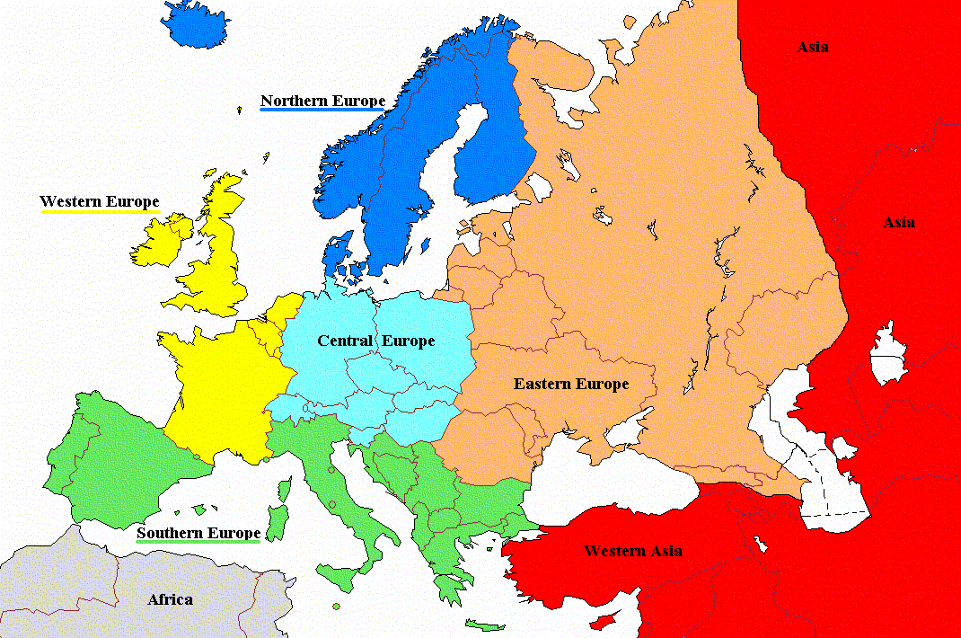
English: Regions of Europe with labels and corrected coloring |
| Datum | |
| Quelle | File:Regions_of_Europe_Map.png |
| Urheber | Koyos |
| Andere Versionen |
|

Lizenz
| Ich, der Urheberrechtsinhaber dieses Werkes, veröffentliche es als gemeinfrei. Dies gilt weltweit. In manchen Staaten könnte dies rechtlich nicht möglich sein. Sofern dies der Fall ist: Ich gewähre jedem das bedingungslose Recht, dieses Werk für jedweden Zweck zu nutzen, es sei denn, Bedingungen sind gesetzlich erforderlich. |
Dateiversionen
Klicke auf einen Zeitpunkt, um diese Version zu laden.
| Version vom | Vorschaubild | Maße | Benutzer | Kommentar | |
|---|---|---|---|---|---|
| aktuell | 12:06, 19. Aug. 2022 | | 1.070 × 710 (319 KB) | Рагин1987 | Cyprus shaded |
| 08:01, 28. Nov. 2011 |  | 1.070 × 710 (171 KB) | DerFreischutz | Changed color according to the boundary. Everything above the border is Eastern Europe. | |
| 11:48, 3. Feb. 2009 |  | 1.070 × 710 (150 KB) | Koyos | reverting geographically inaccurate color coding | |
| 12:40, 18. Jul. 2008 |  | 1.070 × 710 (57 KB) | Aegean Boy~commonswiki | {{Information |Description= |Source= |Date= |Author= |Permission= |other_versions= }} | |
| 11:29, 23. Aug. 2006 |  | 1.070 × 710 (150 KB) | Aongus | {{Information |Description=Regions of Europe |Permission= {{PD}} }} |
Dateiverwendung
Globale Dateiverwendung
Die nachfolgenden anderen Wikis verwenden diese Datei:
- Verwendung auf af.wiktionary.org
- Verwendung auf cdo.wikipedia.org
- Verwendung auf es.wikipedia.org
- Verwendung auf nl.wiktionary.org
- Verwendung auf sh.wikipedia.org
- Verwendung auf sl.wiktionary.org
- Verwendung auf sq.wikipedia.org
- Verwendung auf sr.wikipedia.org